Encyclopedia > Geography of the Spratly Islands
Geography of the Spratly Islands
Geographic coordinates: 8 38 N, 111 55 E
Map references: Southeast Asia
Area:
total:
less than 5 sq km
land:
less than 5 sq km
water:
0 sq km
note:
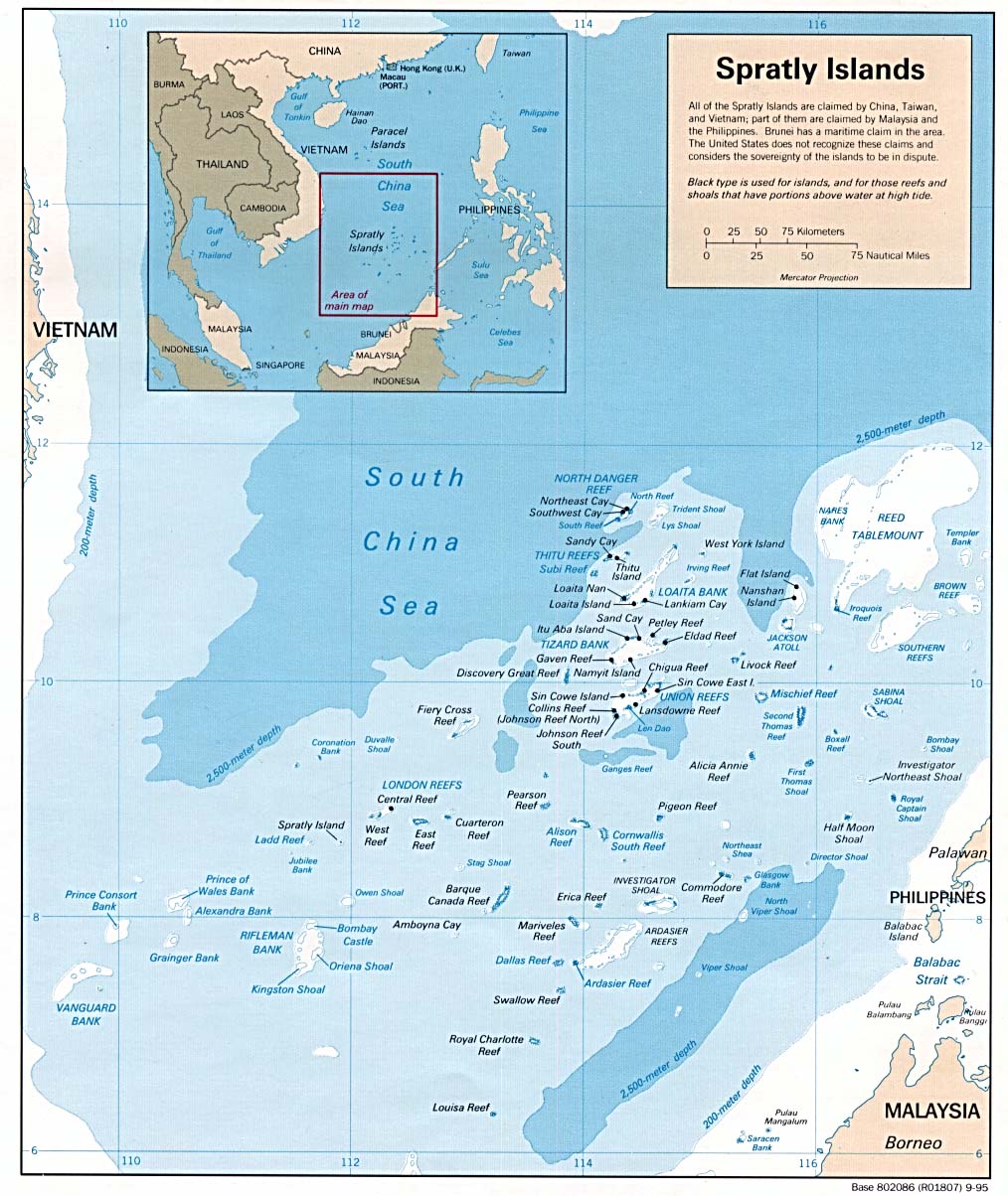
includes 100 or so islets, coral reefs, and sea mounts scattered over an area of nearly 410,000 sq km of the central South China Sea
Area - comparative: NA
Land boundaries: 0 km
Coastline: 926 km
Maritime claims: NA
Climate: tropical
Terrain: flat
Elevation extremes:
lowest point:
South China Sea 0 m
highest point:
unnamed location on Southwest Cay[?] 4 m
Natural resources: fish, guano, undetermined oil and natural gas potential
Land use:
arable land:
0%
permanent crops:
0%
permanent pastures:
0%
forests and woodland:
0%
other:
100%
Irrigated land: 0 sq km (1993)
Natural hazards: typhoons; serious maritime hazard because of numerous reefs and shoals
Environment - current issues: NA
Geography - note: strategically located near several primary shipping lanes in the central South China Sea; includes numerous small islands, atolls, shoals, and coral reefs
- See also : Spratly Islands
- Detailed large map (http://www.lib.utexas.edu/maps/middle_east_and_asia/spratly_95.jpg)
- Diagramatic indications of Occupation (http://www.fas.org/man/dod-101/ops/war/spratmap.gif)
All Wikipedia text is available under the terms of the GNU Free Documentation License
|
Search Encyclopedia
|
Featured Article
|